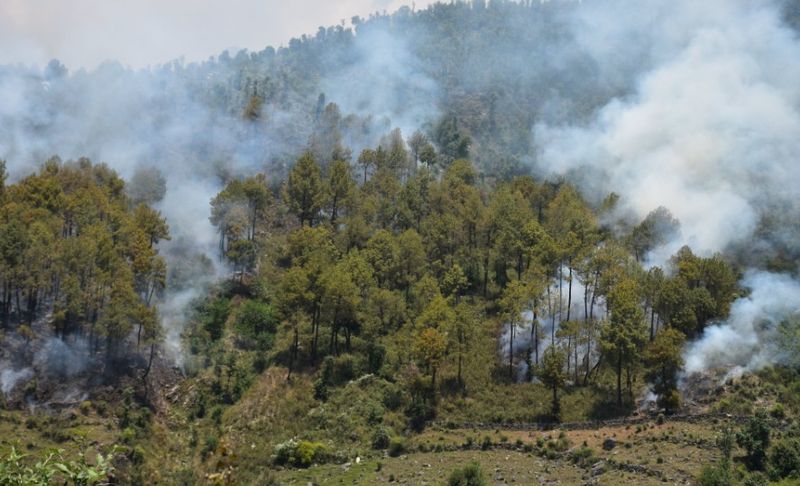
A comprehensive study conducted by scientists at CSIR-Institute of Himalayan Bioresource Technology has revealed alarming trends in forest fire patterns across the Western Himalayas, with fires becoming increasingly frequent and gradually shifting towards higher altitudes due to changing climatic conditions.
The research, based on two decades of satellite observations, was carried out by Dr Amit Kumar and his research scholar Dr Sunil Kumar. The study found that the Western Himalayan region records nearly 1,300 forest fire incidents annually on average.
According to the findings, the forest fire season extends from February to June, with the highest number of incidents occurring in May, when rising temperatures and prolonged dry spells create favourable conditions for rapid fire spread.
The month-wise analysis showed distinct regional patterns in fire occurrence. Forest fires begin as early as February in Uttarakhand, followed by March in Himachal Pradesh, April in Jammu and Kashmir, and May in Ladakh. Researchers noted that while many fires are triggered by human activities, climatic factors such as rising temperatures and prolonged dry conditions significantly intensify their spread.
The study identified Chir pine-dominated forests as the most vulnerable, accounting for nearly 57 per cent of total fire incidents. Deciduous broadleaf forests contribute around 24 per cent, followed by shrublands. Among the Himalayan states, Uttarakhand emerged as the most fire-prone region, followed by Himachal Pradesh, Jammu and Kashmir, and Ladakh.
Researchers also observed that despite an increase in forest cover across the Himalayan states, growing biomass and mounting human pressure may be contributing to the rising frequency of forest fires, particularly in Uttarakhand. Significantly, the study found that land surface temperature has a stronger influence on fire occurrence than rainfall, highlighting the growing impact of climate warming on the fragile Himalayan ecosystem.
Using advanced Remote Sensing and GIS-based techniques, the CSIR-IHBT team mapped fire hotspots and assessed fire frequency and intensity across the region. In Kangra district of Himachal Pradesh, the analysis revealed that more than 50 per cent of forest areas are vulnerable to fires, while nearly 10 per cent fall under high-risk zones. Thousands of villages were also found to be located in fire-sensitive areas, posing serious threats to biodiversity and rural livelihoods.
To strengthen forest fire monitoring, CSIR-IHBT has installed a PhenoMet system at Baba Balaknath Temple to study climate-vegetation interactions in fire-prone Chir pine forests. The automated system combines a time-lapse camera with advanced weather-monitoring instruments to record temperature, humidity, rainfall, solar radiation, and vegetation changes in real time, thereby improving fire-risk assessment and early warning capabilities.
Dr Sudesh Kumar Yadav stressed the need for stronger early warning systems and modern GIS-based forest management practices, including drone-enabled thermal and multispectral monitoring supported by ground-based observations. He said such initiatives would strengthen climate-informed forest fire management and support biodiversity conservation in the ecologically sensitive Himalayan region.